MAP=TREE

地形図の年輪のイラストレーション

Digital Illustration
Year: 2017

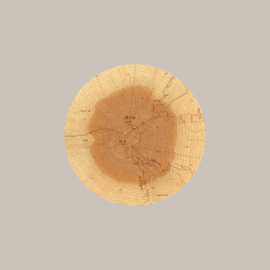
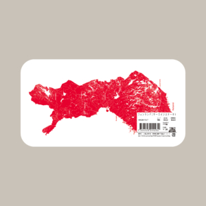
Recording the process of how to simulate the topographic maps such as the well-known symbol of Japan: Mt.fuji to the colored tree ring patterns that everyone is familiar with. The unexpected similarities between tree rings and maps will be remarkable.
地形図の等高線を年輪に見立てて、木目の表情を再現した。緻密に描かれた木々の細部を見ると、山々の地形図であることがわかる。この地形図から浮かび上がる年輪たちの精密な表情こそ、本作の特徴だ。眺めていると、普段目にする年輪や木目のみならず、様々な物が何処かの地形図に見えてくるかもしれない。(2018年にタモリ倶楽部で紹介)

WORKS

  • MAP=SNOWFLAKES

    MAP=SNOWFLAKES

  • MAP=TREE

    MAP=TREE

  • MAP=MEAT

    MAP=MEAT